Off-grid
Connected where there's no signal
Hiking, skiing, overlanding? Pair Flaresat with a LoRa radio to track live positions and chat without any cell service, across kilometres.
Powered by LoRa mesh. No towers required.
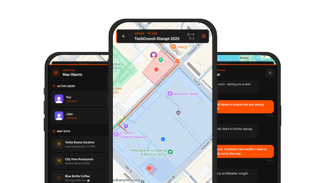
Built for teams where coverage ends. Pair a LoRa radio and keep your whole operation on one live map, tracking, chat, pins, routes. No cell signal needed. Syncs to the cloud when you're back online. iOS, Android, web. Free.
No IT setup. No training manual. Create a group, share the link, and your team is on the map.
Tap +, name your group, pick a colour. Your shared live map is ready in under 30 seconds, no setup, no IT, no configuration.
Share a link or QR code. Anyone on iOS, Android, or browser joins instantly, no account needed.
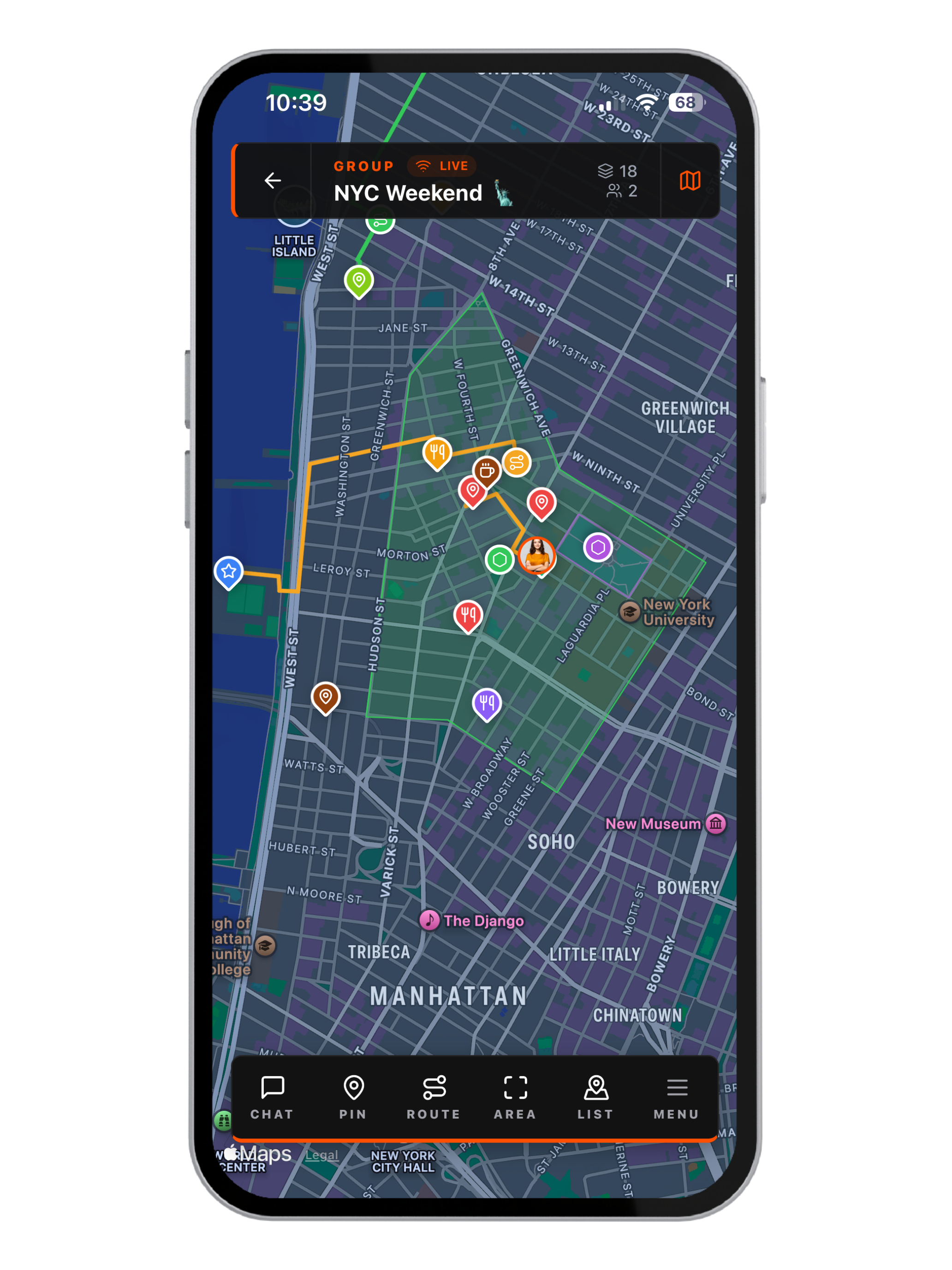
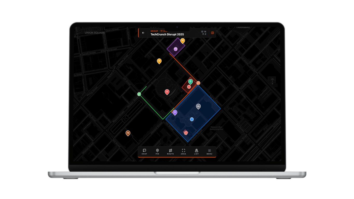
See everyone move live. Drop pins, draw routes, chat in context. Pair a LoRa radio and keep the whole operation running with zero cell signal.
Live maps, encrypted mesh, voice notes, and cross-platform sync, in one focused app that doesn't get in the way.
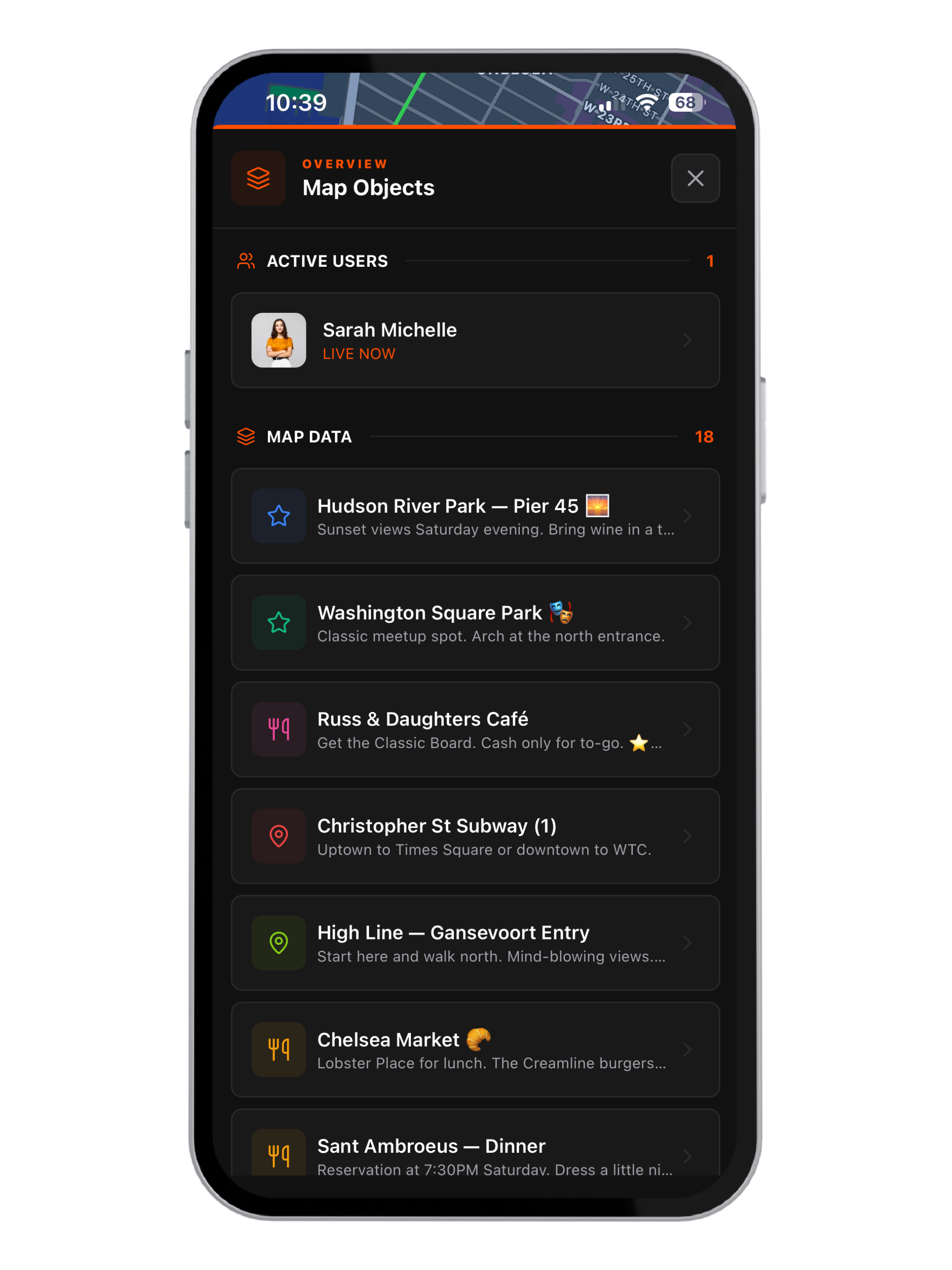
No more “where are you?” Every member appears on the shared map the moment they join. Live. No refresh.
Pair with a LoRa radio to keep tracking and chatting over mesh. 10 km+ range. No cell towers. No subscription.
Messages overlay the live view. Tap any location in chat to fly straight to it. Works on mesh too.
Online groups for the city. Mesh channels for the mountains. Add an org for shared roles and invites.
Start on your phone, switch to the desktop view. Same data, always in sync.
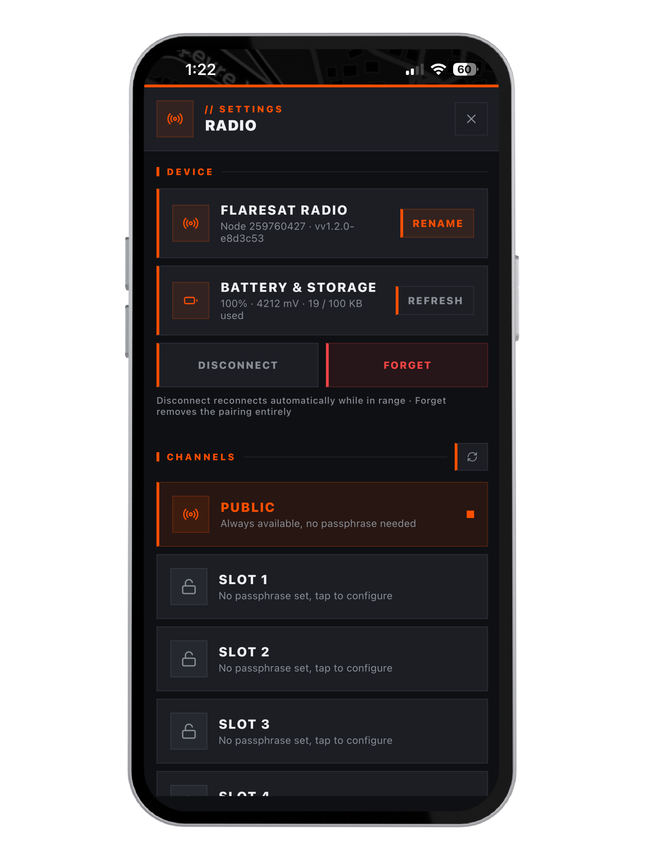
Pair your device, tune its settings, and set up encrypted channels - no separate app required.
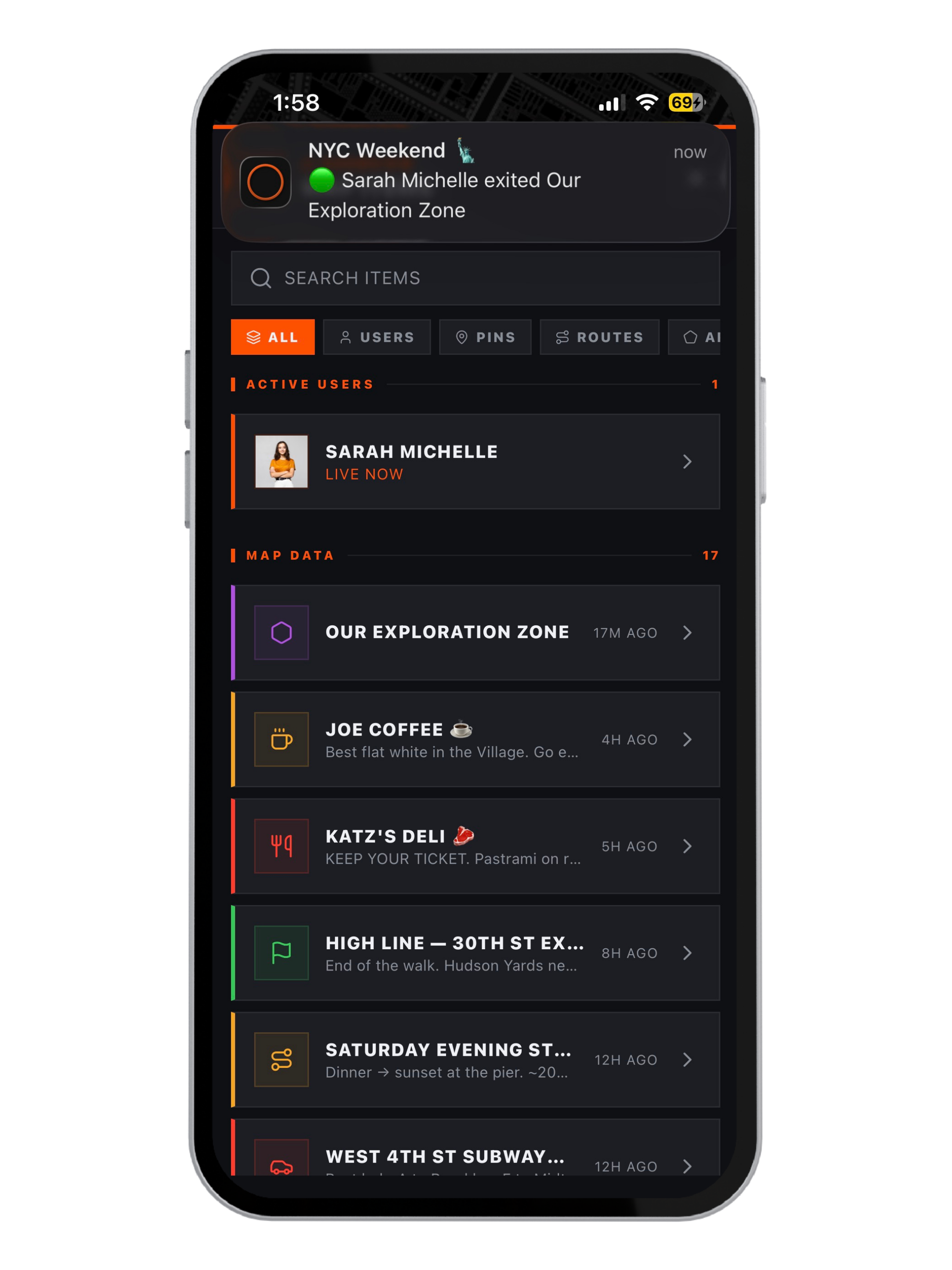
Draw a zone. The moment a member or LoRa radio tracker enters or exits, every teammate gets a push notification instantly.
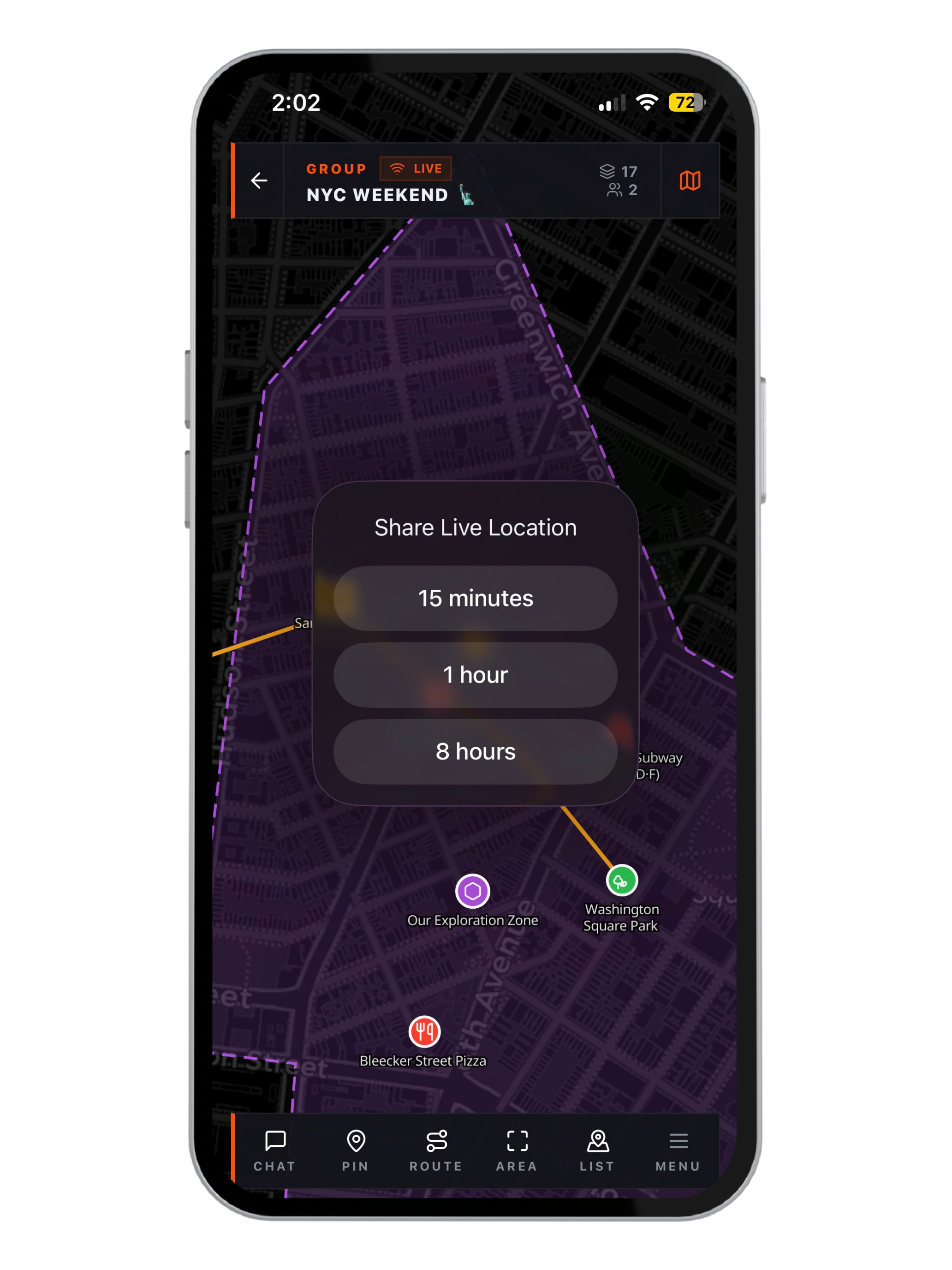
Start a Live Share session, 15 minutes, 1 hour, or up to 8 hours, and your location keeps broadcasting even with the phone locked.
Relay Bridge links your mesh group to an online group, everything syncs both ways automatically. Your teammate on a LoRa radio in the mountains drops a pin. The coordinator on a laptop at base camp sees it instantly.
Summit Pin
Alex · 2 min ago
Moving to grid ref B4
Alex · 8 min ago
Summit Pin
Moving to grid ref B4
Everything you need to mark the world and share it with your team - in real time.
Drop Pins
Name, describe, coordinate
Draw Routes
Trace any path with a finger
Mark Areas
Shade zones, grids, sectors
Compass & Heading
Live bearing HUD
Geofence Alerts
Enter/exit zone notifications
Weather Overlays
Rain, wind, temp, pressure
One-Tap Navigate
Apple Maps or Google Maps
Photo Attachments
Attach photos to any pin or route
Place Search
Jump to any city, address, or landmark
See everyone move live, chat in context, and organise multiple events without the chaos.
Live Tracking
Every member, real-time
Map Chat
Talk without leaving the map
Voice Notes
Send audio in-group
Organizations
Nested groups, three-tier roles
Live Share
Background broadcast up to 8 hrs
QR Invites
Scan to join, no typing
Pair with a LoRa radio and keep your whole team on the same map - no cell service needed.
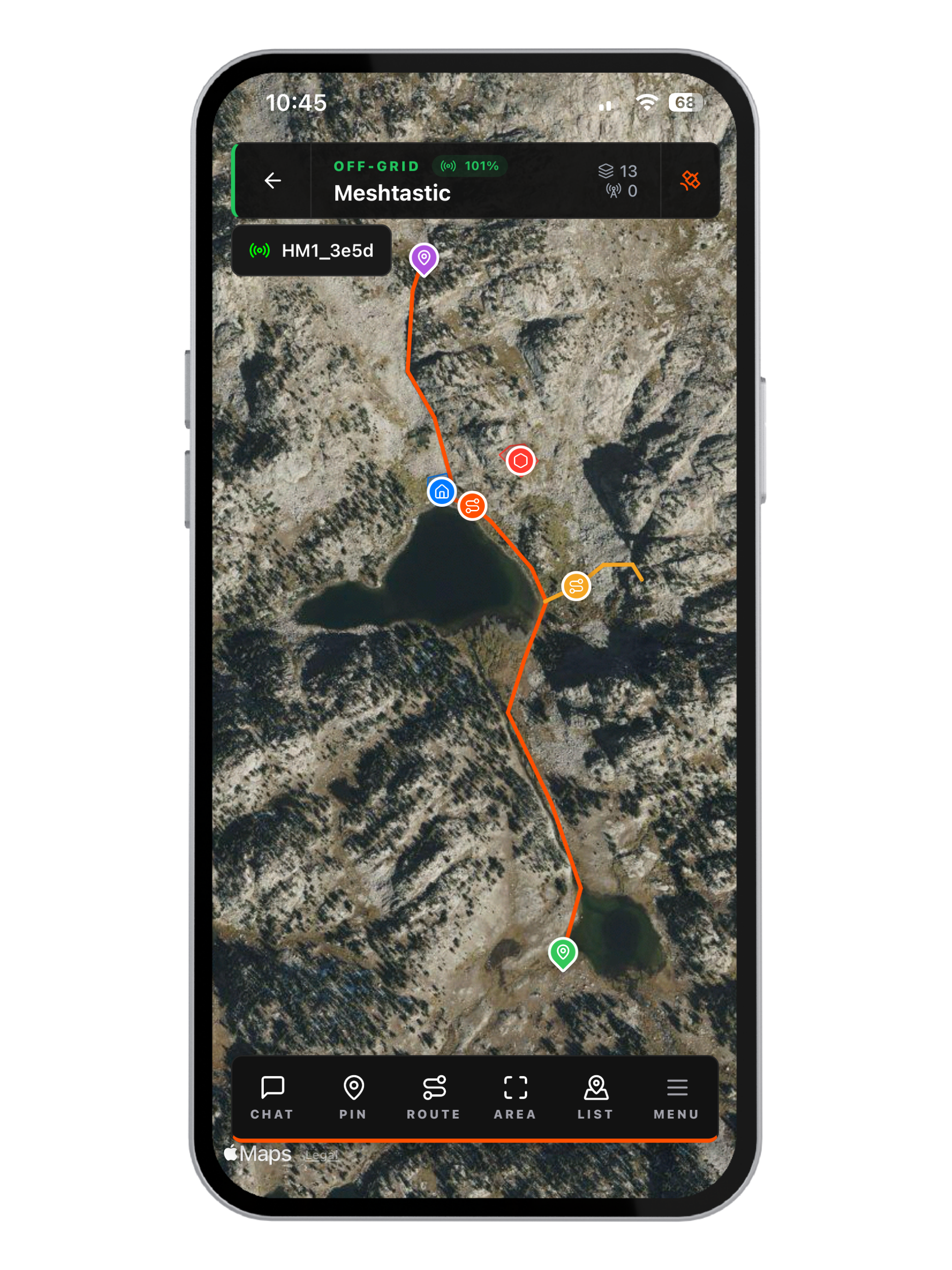
LoRa Mesh
Self-healing radio network
Offline First
Maps cached, app keeps working
Relay Bridge
Mesh ↔ online, both ways
AES-128
Passphrase-encrypted channels
Delivery Status
Pending, sent, or failed
Node Tracking
Any mesh node on map
No Account Needed
Jump in radio-only without signing up
Full Device Control
TX power, repeater mode, GPS, diagnostics
Pair Flaresat with a LoRa radio to track locations and communicate completely offline. No cell towers. No subscription. Just physics.
Your message hops from node to node to reach its destination. If one device drops, the network reroutes automatically.
Every member's location is broadcast efficiently over the mesh and rendered live on your Flaresat map - no internet needed.
Set a passphrase on any channel slot and your locations and chats become invisible to anyone without it.
Link a Radio group to an online group. Pins, routes, and messages sync both ways - your whole team stays on the same map.
10 km+
Range
AES-128
Encryption
Multi-hop
Self-healing
No SIM
Fully offline
Flaresat adapts to any group, any occasion, from city streets to mountain peaks, from concert grounds to search operations.
Hiking, skiing, overlanding? Pair Flaresat with a LoRa radio to track live positions and chat without any cell service, across kilometres.
Powered by LoRa mesh. No towers required.
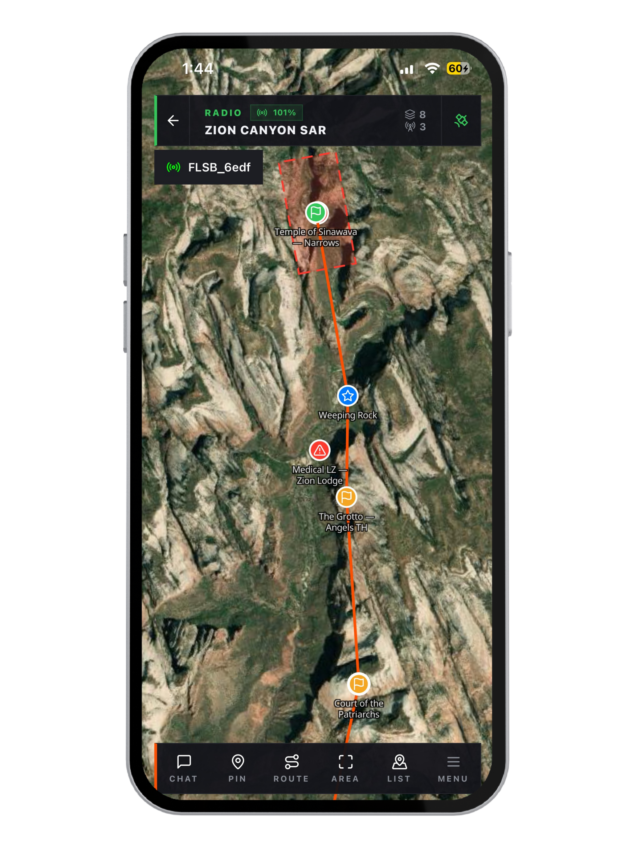
Real-time situational awareness for volunteer responders. See every member's position, mark cleared zones, and coordinate hand-offs over the mesh.
Trusted by SAR teams and first responders.
Mark blinds, track sightings, see safety lines. Communicate silently over the mesh network without spooking the target.
Works deep in the woods with zero reception.
Safety teams, medical crews, and stage ops run Flaresat when RF-jammed crowds knock out cell service. Every crew member visible, every zone marked.
Festivals, large venues, outdoor events.
Pin the campsite, share waypoints, track every vehicle in your convoy in real time. No cell signal between stops? The mesh keeps the group connected.
Off-road trips, remote expeditions, caravans.
See every patrol's position live, drop incident pins instantly, set alert zones around critical areas. Coordinates in silence over the radio mesh.
Private security, site patrol, perimeter ops.
Every person in your group carries a small LoRa device. It pairs to Flaresat over Bluetooth and transmits location, pins, and messages over radio waves, no SIM, no data plan.
Zero cell service needed
Location, pins, and messages travel over radio waves, no towers, no SIM, no plan.
AES-256 encrypted
Every transmission is encrypted with your group's private key. Invisible to outsiders.
Self-healing mesh
Messages hop from node to node. If one device goes offline the network reroutes.
Up to 10 km between devices
LoRa signals reach across open terrain, through dense forest, and into valleys where cell coverage doesn't exist.
Free. No credit card. Your first group is live in under a minute.

